 |
San Jacinto, Battle of
|
Marker Title: |
Site of Battle of San Jacinto, 1836 |
|
Address: |
|
|
City: |
Houston |
|
County: |
Harris |
|
Year Marker Erected: |
1936 |
|
Designations: |
na |
|
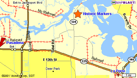
Marker Location: |
from Houston take La Porte Frwy. E (SH 225) to Battleground Rd.
exit (SH 134), go north; marker is on west side of road |
|
Marker Text: |
Near here on the afternoon of April 21, 1836, the army of the
Republic of Texas, commanded by General Sam Houston was drawn
up to attack an invading Mexican army commanded by General Antonio
Lopez de Santa Anna. |
|
 |
Texas
Army Attacked in Four Divisions
|
Marker Title: |
Texas Army Attacked in Four Divisions |
|
Address: |
|
|
City: |
Houston |
|
County: |
Harris |
|
Year Marker Erected: |
1936 |
|
Designations |
na |
|
Marker Location: |
from Houston take La Porte Frwy. (SH 225) E to Battleground Rd.
(SH 134), go north |
|
Marker Text: |
- The Cavalry on the right, commanded by Mirabeau B. Lamar; next,
the Infantry under Lieutenant Colonel Henry Millard and the "Twin
Sisters" cannon under Colonel George W. Hockley; the 1st
Regiment in the center under Colonel Edward Burleson; the 2nd
Regiment, the left wing, under Colonel Sidney Sherman. |
|
Mexican
Cavalry, Battle of San Jacinto
|
Marker Title: |
Mexican Cavalry, Battle of San Jacinto |
|
Address: |
|
|
City: |
Houston |
|
County: |
Harris |
|
Year Marker Erected: |
1936 |
|
Designations: |
na |
|
Marker Location: |
San Jacinto State Park, SH 134 |
|
Marker Text: |
The Mexican Cavalry was on the left wing, Infantry and Artillery
in the center behind a fortification of boxes and baggage, while
the extreme right was far extended. |
|
San
Jacinto, Battle of
|
Marker Title: |
Within A Few Minutes, Battle of San Jacinto Site |
|
Address: |
|
|
City: |
Houston |
|
County: |
Harris |
|
Year Marker Erected: |
1936 |
|
Designations: |
na |
|
Marker Location: |
from Houston take LaPorte Frwy. E (SH 225) to Battleground Rd.
(SH 134), go north |
|
Marker Text: |
Within a few minutes the Battle of San Jacinto was over. According
to General Houston's report 630 Mexicans lay dead on the field,
208 were wounded and 730 were taken prisoners. Money, arms and
equipment were captured. The Texans had 9 killed and 30 wounded. |
|